In July 2020, Lauhanvuori—Hämeenkangas Geopark became Finland’s second UNESCO Global Geopark after Rokua. Gaining status has required years of work, long-term commitment to development by the people in the region and flexible project funding. Work will now continue together as part of the global Geopark network.
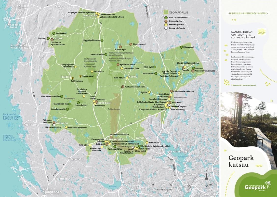
Lauhanvuori—Hämeenkangas UNESCO Global Geopark is located in Western Finland in the border area of three provinces: In Southern Ostrobothnia, Geopark municipalities include Kauhajoki, Isojoki and Karijoki. In Satakunta, it includes Kankaanpää, Karvia, Honkajoki, Jämijärvi and Siikainen. In Pirkanmaa, the geopark includes Parkano and Kihniö. For many years the municipalities have been developing the area towards membership of the UNESCO Global Geopark network in close cooperation with Metsähallitus (the Finnish Forest Administration), Luonnonvarakeskus, companies, associations and residents and numerous other partners.
The main geological theme of the Lauhanvuori—Hämeenkangas UNESCO Global Geopark describes the evolution of the landscape from the ancient mountain to the present marshland. The most important internationally important features of the region are Lauhanvuori’s long and multi-stage geological history, valuable marshes, Susiluola and some of the finest springs in Finland.
Preparations for the UNESCO Geopark status
“Preparing for the search for Geopark status has required extensive development of the region, comprehensive cooperation, investments and inventories, selection and long-term commitment to the continued development and maintenance of Geopark in the future” lists Terttu Hermansson, Executive Director of Lauhanvuori–Hämeenkangas Geopark.
“Under Metsähallitus’s leadership, camping services have been built and guided materials have been produced. The municipalities have also developed the Geopark area and activities through wonderful joint projects. The geopark is not a protected area, but a tool to develop a geologically valuable area and its vitality and to highlight the valuable geology, nature and culture of the region” Hermansson adds.
The majority of geosites are located in the areas of Metsähallitus, which makes Geopark relies on Metsähallitus systems, customer safety work and nature conservation practices. Metsähallitus’s completed services, resources and support have facilitated Geopark preparation and have had a positive impact on gaining status. In addition to resources, in assessing Geopark eligibility, the region was praised for the good cooperation and networking that benefits everyone, the environmental education work of the schools Geopark, and the visibility of Geopark in various ways in terrain, printed materials and virtual.
When progress has been pushed to the beginning in many sectors, there are other positive things in the region. Examples of fine local Geopark-related initiatives serve as examples of e.g. The running of the GeoUp café in the former Ant Nature Centre in Lauhanvuori by Honkajoki entrepreneurs, a wide range of companies’ Geopark products, independently organised tours by Geopark Rangers for children and other groups, fantastic outputs of pupils in schools and events Under the Geopark brand.
“Geopark is the result of joint work in the region, we are grateful for the extensive work that people have done in the area and how they are committed to the joint development of Geopark. The work has required ongoing project funding, which has been received through the Centres for Economic Development, Transport and the Environment and Local Action Groups in the region” Henderson praises.
All Geopark projects have been implemented with rural funding, without it there would be no Geopark. As a source of finance, it is versatile and therefore very suitable for Geopark when needs have been diverse: infrastructure, content, operating models, cooperation, visibility, training models have been developed and inventoried. In addition, Metsähallitus, municipalities and associations have qualified as administrators. Projects have been able to respond effectively to all the requirements and criteria required by UNESCO. Project cooperation in the different provinces has also been excellent and has added value to Geopark when it has been possible to work together and share resources.

The UNESCO brand and what to do now
The UNESCO Global Geopark brand is a guarantee of quality for the tourist and, in principle, increases international tourism in the region. According to Metsähallitus’s calculations, the number of visits to the National Parks in the Hämeenkangas Geopark area has already grown staggeringly during the last three years: in Lauhanvuori by more than 20%, in Kauhaneva-Pohjankangas by up to 65%, and in 2020 is still expected wilder numbers. In addition to improving geopark visibility and camping services, the number of visits to destinations has also been affected by the growth in popularity of nature camping. The region’s extensive tourist service offerings are compiled on the Lhgeopark.fi website.
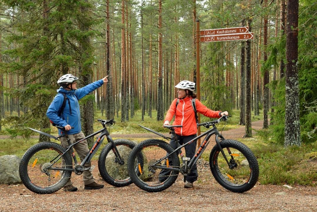
Lauhanvuori—Hämeenkangas Geopark is working hard. Geoparks are assessed every four years and you can lose status if left to rest. Continued development ensures quality and success as a Geopark, and the park has several projects in progress. The focus now is on developing tourism, promoting digitalisation and sustainable tourism, building bike tourism routes and services to design environmental education and camp school packages, and further enhancing the visibility of the Geopark.

Metsähallitus is continuing to develop the geopark’s camping facilities. For example, locating areas have been expanded in Lauhanvuori, stairs were built on the steepest slopes in Katikankanjoni, and accessible structures and a stopping place has been added to Kauhaneva.
With the UNESCO status, internationalism will increase and more opportunities for international cooperation in all sectors will be opened up in the region.
To help you with adventures at Lauhanvuori Hämeenkangas Geopark:

